
Optimization Projects
Recommended Projects
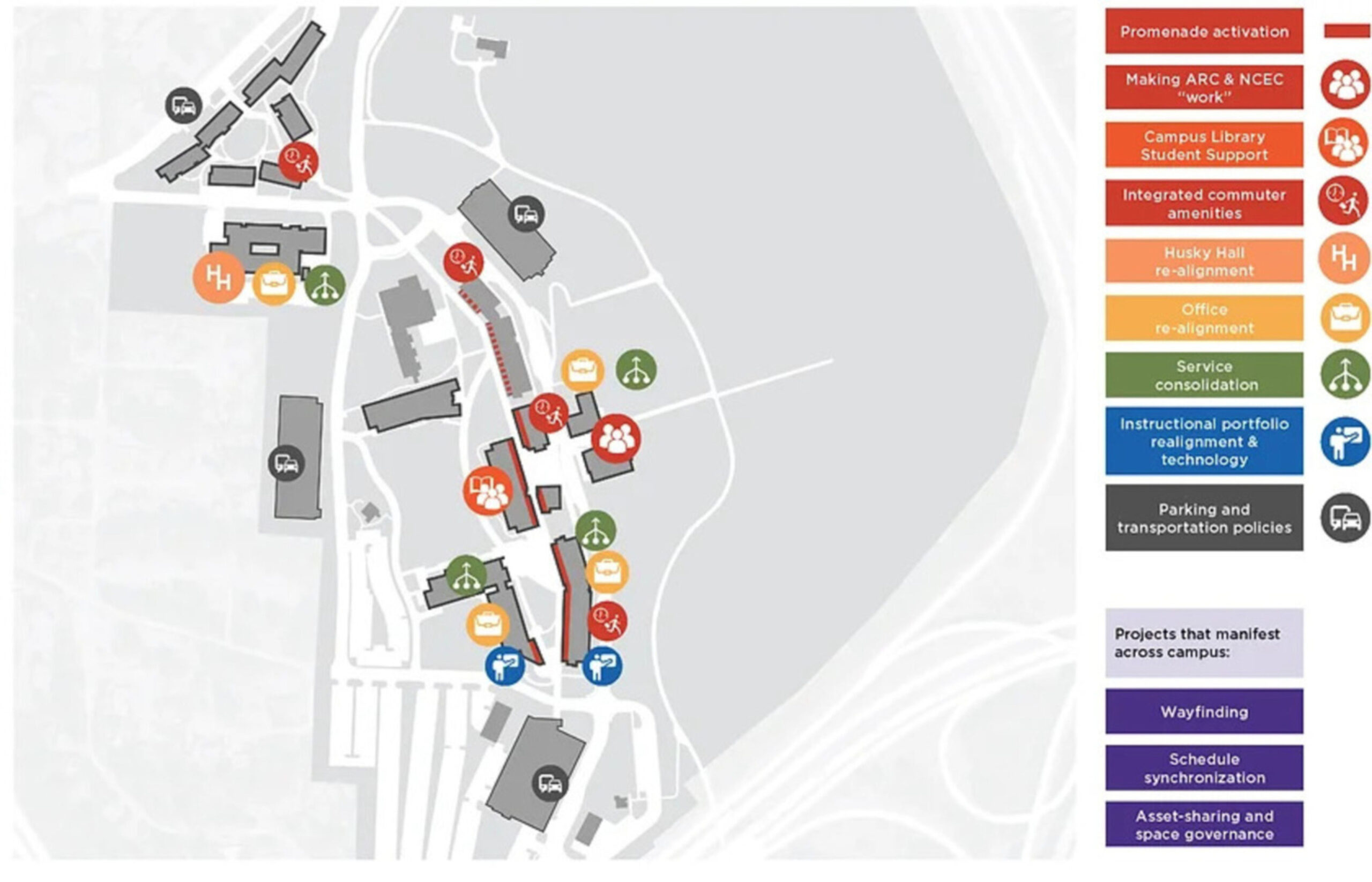
The recommended projects touch virtually every aspect of the campus physical environment to enhance the quality, quantity, operations and flow of the facilities on campus. While each project is important in its own right, the recommendations are also designed to create synergies across projects to collectively improve the experience of life and learning on campus, and bring students, staff and faculty together in a stronger shared experience.
Optimization Roadmap
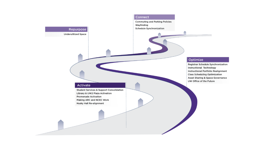
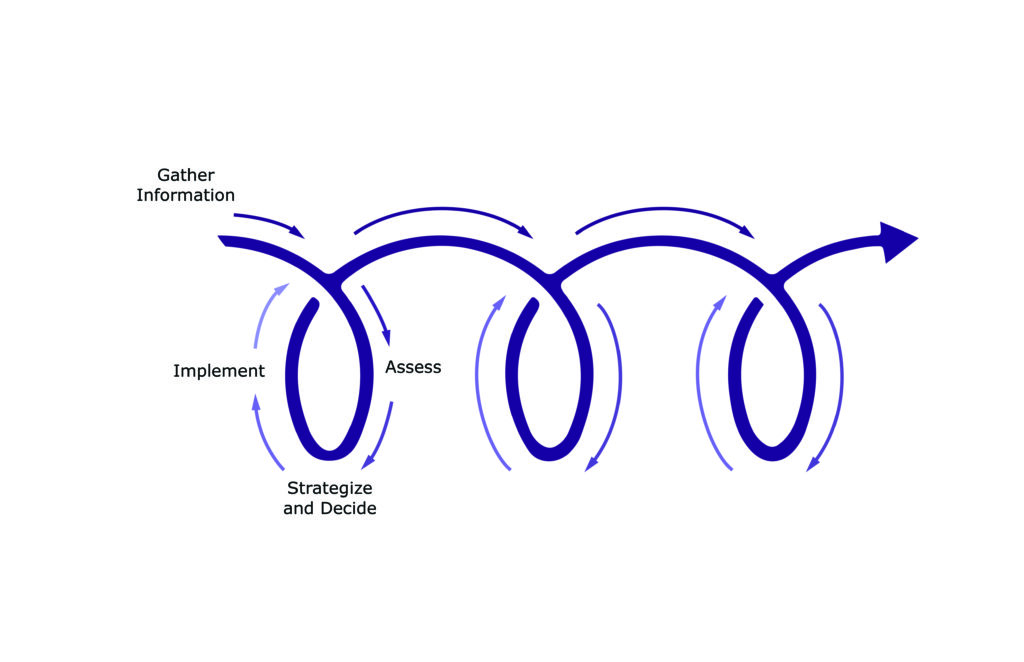
As much as it might want to, the university simply can’t accomplish all Recommended Projects at the same time. Some initiatives, like Repurpose Projects, are designed to unlock space to make way for activation projects. Others, like the projects in the connect bucket, will serve to stitch several projects together. The Project Roadmap takes these interdependencies into account and outlines a high-level framework for prioritizing campus optimization projects over the next five to seven years.
Activate
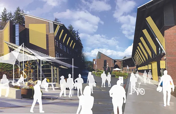
Picture the promenade as a vibrant pedestrian ‘Main Street’ with strong, transparent indoor-outdoor connections and ground floor uses that serve the full community from Beardslee Boulevard to the “Big W”. Projects in this category focus on providing strategically located amenities and services along the central promenade’s ground level for students, staff and faculty to build stronger relationships on campus. To do this, we will re-distribute and cluster student services, amenities, study and collaboration spaces along the central spine and expand hours of use to accommodate commuters and residential students alike.
Optimize
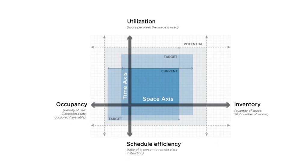
These projects focus on expanding the effective capacity of space on campus by making our learning, studying, interaction and office spaces work more effectively for their intended activities. The graphic shows how the University of Washington Bothell is seeking to expand its effective capacity on campus by implementing projects across the dimensions of space and time.
Projects along the horizontal axis focus on improving the use of space by expanding or improving the physical inventory and/or by improving the occupancy and performance of that space. Projects along the vertical axis are all about leveraging time to make that space more effective. For instance, we can increase the amount of time that a space is in use and/or we can leverage off-site activities like remote classes or remote work to expand capacity. Time related projects focus on things like scheduling and curriculum design to achieve more effective capacity.
Repurpose
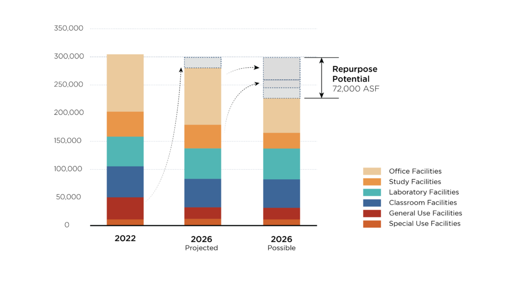
Repurpose projects are designed to free up underutilized space to make way for high priority interaction, collaboration and study space. For example, we estimate that about 40,000 square feet can be harvested by recalibrating office environments to meet an increasingly hybrid and remote work culture. An additional 14,000 square feet can be harvested by relocating low-circulation book collections from core student study areas in the library. These possibilities along with the space made available by the bookstore relocation collectively unlock enough space to fill a building the size of Discovery Hall.
Connect
These projects are the connective tissue that knits the campus improvements together via new policies, procedures and spatial identities. Some, like new parking and transportation policies are designed to remove some of the barriers students and faculty face that prevent them from fully participating in on-campus life. Others, like new wayfinding and signage programs are designed to bring clarity to the experience of navigating the entire campus across both the digital and physical domains. These projects are conceived of as programs that also measure, consider and evaluate effectiveness on an ongoing basis and adjust as needed to become more optimally tuned to the campus activity and direction.