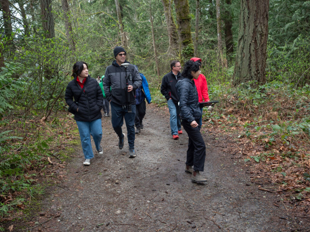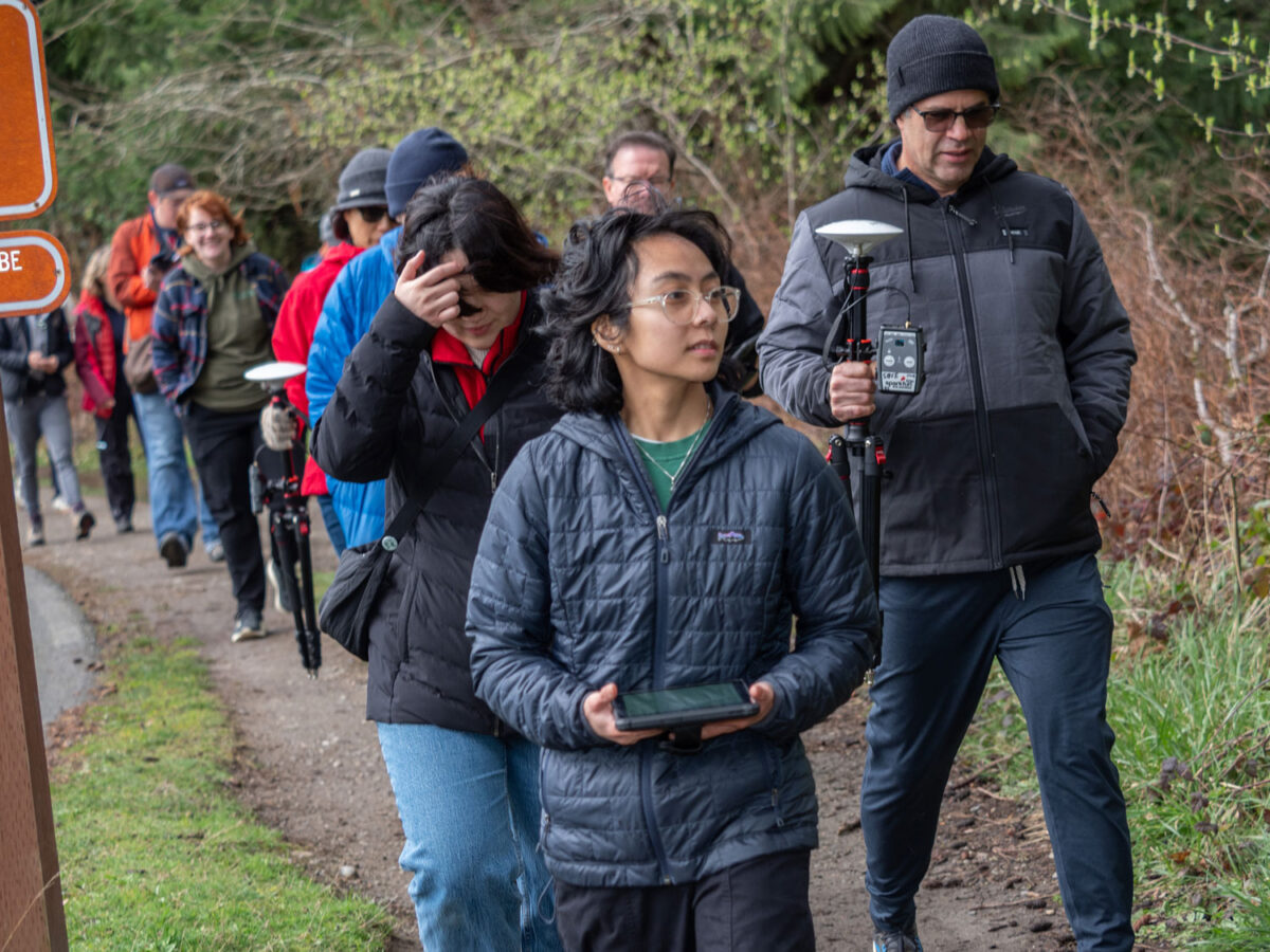
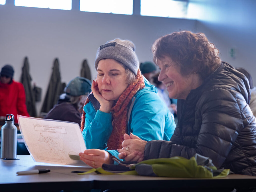
On a soggy Saturday in March, more than 30 volunteers gathered in Kenmore’s Saint Edward State Park to help re-map the trails that wind through the popular green space. University of Washington Bothell student intern Janelle Adsuara led “Mapping the Park 101,” which attracted individuals and families who were mapping hobbyists, outdoor enthusiasts and neighbors eager to try out geographic information systems technology.
All paths in project leader Adsuara’s life seemed to point to Saint Edward State Park. She grew up in the San Francisco Bay Area, where she explored the region’s parks, beaches and trails by foot and bicycle. The similarities she found in greater Seattle, where big cities snug up to vast natural spaces, influenced her decision to pursue a degree in Environmental Studies and a minor in GIS at UW Bothell.
“I’m fascinated by the intersection of urban and natural environments,” she said. “It’s a unique experience that makes me more aware of social injustices — racial, class, public health. How can we make the world more sustainable?”
Annika Halvorson, a volunteer at the event and a recent graduate from the UW in Seattle, had a similar childhood experience outdoors — and desire to make an impact now.
“I grew up going to the playground in the park and the trails, and I would always get lost,” she said. “I wanted to give back to my community and use my knowledge to do some good for the park that I have always loved.”
Volunteer effort ends the “lost” decade
Adsuara kicked off the mapping event with a presentation about GIS and the software that volunteers would use to capture data about trails and other park features. Since 2018, the park has grown by 16 acres. It now encompasses more than 330 acres of forested trails and lawns that surround a former Catholic seminary. Over the years, hikers and mountain bikers have created a half dozen more informal, or social, paths that don’t appear on the park’s official map.
“I frequently get comments from the public about difficulty finding where they are,” said Daryl Kline, park ranger. He last mapped the trails a decade ago — without the benefit of GIS technology.
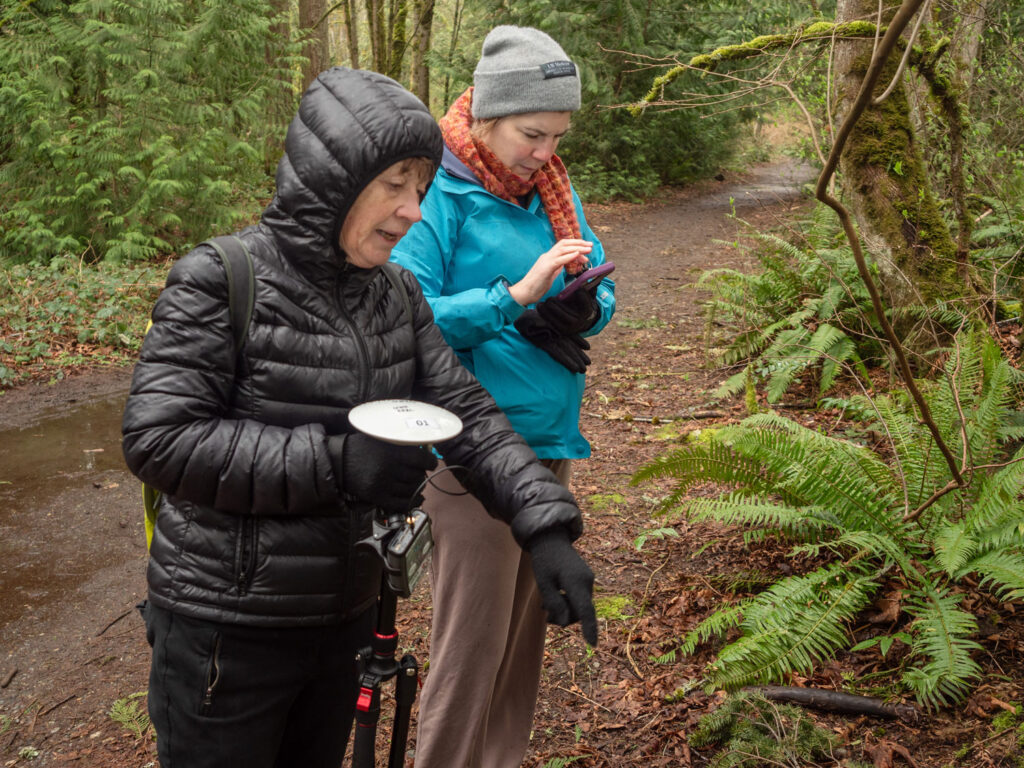
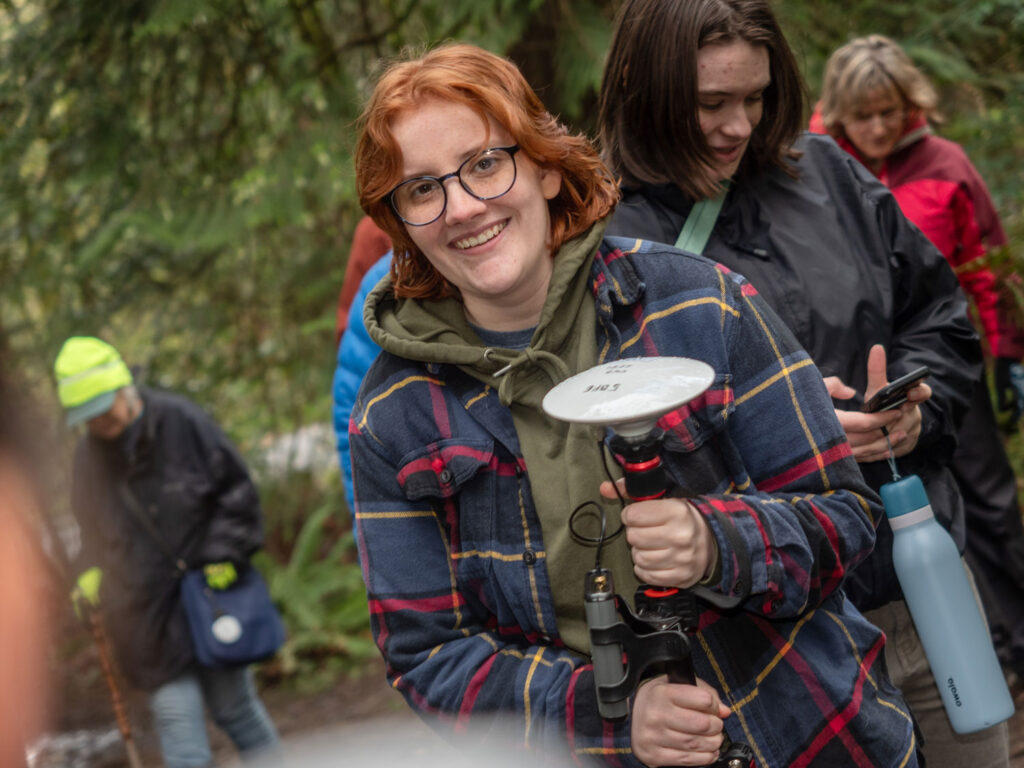
Adsuara was determined to set things right with real-time data. After coaching the volunteers and assigning them tasks, she donned a backpack outfitted with antenna, receiver and a tablet mounted on a tripod. As she walked, she collected data through the tablet. Volunteers had the opportunity to try the tablet, but they mostly relied on their phones.
By using Global Navigation Satellite Systems technology, Adsuara and her team maximized mapping their accuracy. GNSS is more precise than GPS methods alone, she explained, because receivers can simultaneously connect to a series of satellite constellations. This ability provides better coverage and allows the collection of highly accurate data from the source. These data can be further improved with real-time differential correction methods, which help pinpoint a user’s location as they walk the terrain.
Data supports restoration and conservation
Along with foot paths and mountain bike trails, Adsuara and her crew focused on features such as bridges, culverts, notable views (Lake Washington), trail hazards (holes, fallen trees) and invasive species — Himalayan blackberry, English holly, English ivy and two types of laurel: cherry and Portuguese.
“I came out of the day with so much more knowledge of the ecology of the area and how restorations efforts work within the park,” said Halvorson. “I had absolutely no clue there were different types of laurel before, but I definitely do now after mapping them!”
Armed with the data collected by Adsuara and her volunteers, Ranger Kline will update maps at all of the Saint Edward State Park trailheads. In the long term, he plans to reroute foot traffic to formalize a social trail, creating a more scenic hike to the lakeshore. “This data gives me the power to develop the plan and implement it,” said Kline.
He also intends to close a section of the existing trail to allow rehabilitation of a swath of forest.
“Hearing that made me feel like my project isn’t just some silly little thing, a theoretical project,” said Adsuara. “I’m taking data that can be used and put to work for restoration and conservation.”
CoSEE series forges community connections
This mapping event was the latest in a series of free community classes hosted by CoSEE, the Collaborative for Socio-Ecological Engagement at UW Bothell. Unfolding over a few weekend hours, each class gives community members a taste of the University’s curriculum through scientific explorations and discoveries. Previous CoSEE offerings have included Insects 101 and Salmon 101. Next up is Bee Monitoring 101, where attendees will participate in a monitoring practice and learn how bees are beneficial
“One of the major objectives of CoSEE is to connect the work we’re doing here at UW Bothell with the needs of the community,” explained Dr. Santiago Lopez, associate professor in the School of Interdisciplinary Arts & Sciences.
The UW Bothell partnership with Saint Edward State Park goes back to at least 2017, even before the park’s Environmental Education & Research Center opened its doors. But Lopez is quick to give credit for the mapping project to Adsuara, who led it from start to finish. “The success is due to her and the effort she put forth to make this happen,” he said.
The mapping event also inspired at least one person to follow in Adsuara’s academic footsteps.
“I’m taking data that can be used and put to work for restoration and conservation.”
Janelle Asuara, senior, Environmental Studies
One big ecological family
Volunteer Mya Vo is a Media & Communication Studies major at UW Bothell who was already considering a minor in GIS. She’s drawn by its potential applications for public health and environmental policy that supports marginalized groups who face environmental racism.
“Learning about Janelle’s work helped me reaffirm how important different facets of GIS are,” she said, “and how it can be used to support the community.”
For Adsuara, place-based learning is about creating these kinds of connections between human communities, the land and its inhabitants.
When she first came to Saint Edward State Park, she found the sheer variety of plants and trees a bit overwhelming. Today, Adsuara can readily distinguish between a Douglas fir and a Western red cedar, a big-leaf maple and a black cottonwood. This intimacy has deepened her sense of belonging to the environment.
“I have a better sense of history,” she said, “and a better sense of how Indigenous people used the land. This work has given me an even greater sense of respect for the people who were on the land before we came onto it.”